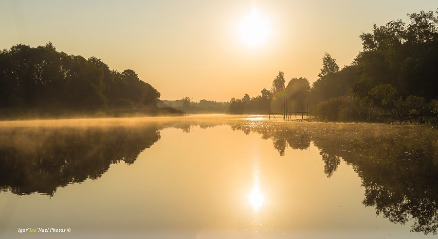
The Estonian water network is dense, because the amount of precipitation exceeds evaporation here
Watercourses
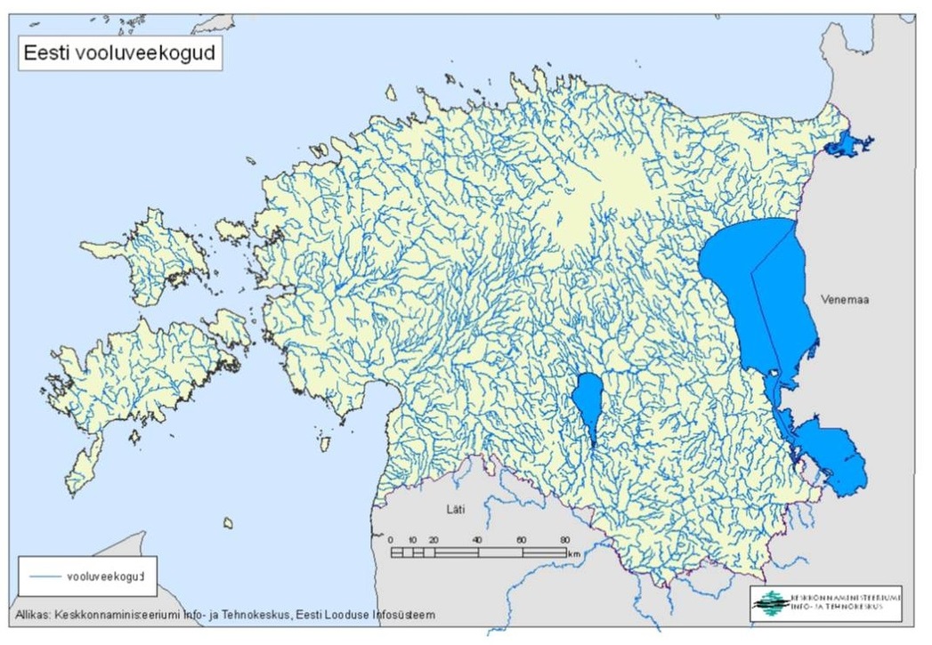
There are thousands of watercourses in Estonia – according to the literature, more than 7,300 – with a total length of more than 31,000 km [1]. There are almost 3000 watercourses registered in the Estonian Nature Information System [2]. Most Estonian watercourses are short (94.3%), up to 10 km long [1].
There are 11 rivers over 100 km long in Estonia (according to the Estonian Nature Information System, as at 01 November 2023):
- Võhandu River - 165,1 km
- Pärnu River- 144,6 km
- Põltsamaa River - 136,2 km
- Pedja River - 125 km
- Kasari River - 114,7
- Keila River - 111,9 km
- Pirita River - 107 km
- Õhne River - 105,9 km
- Piusa River - 104,2 km
- Ahja River - 103,9 km.
There are 15 rivers with a catchment basin larger than 1,000 km2 in Estonia [3]. The Narva River has the largest catchment basin (56,153 km2, of which 17,235 km2 is within Estonia) [2]. According to the internationally used scale of river length size classes (very small < 25 km, small 26–100 km, medium 101–500 km, large 500–1,000 km, and very large > 1,000 km), almost all Estonian rivers are very small or small, a few are medium-sized, and the Narva river could be considered a large river (if the length of the Narva river also includes its tributary Velikaya) [1].
The Estonian water network is dense, because the amount of precipitation exceeds evaporation here. At the same time, the distribution of watercourses is very uneven. The lowest density of watercourse networks is in the Pandivere Uplands and in the coastal areas of the islands, the highest in Northern Estonia [1]. Geologically, the Estonian river network is quite young. It developed after the retreat of the continental ice, i.e. during the last approx. 13,000 years. The rivers of South Estonia were released from the ice sheet first. Their upper reaches usually have a faster flow than the lower reaches, the river valleys are wide and deep, and covered with thick sediments at the lower reaches. Some rivers in Northern Estonia fall over the edge of the klint downstream, forming waterfalls. Others flow in deep valleys and have no waterfalls. The rivers of Northern Estonia mostly have fast-flowing lower reaches and slow-flowing upper reaches. The youngest rivers are located in Western Estonia. These rivers have a small, more or less uniform slope, which means that the water flow in them is usually slow and the beds often meander [4].
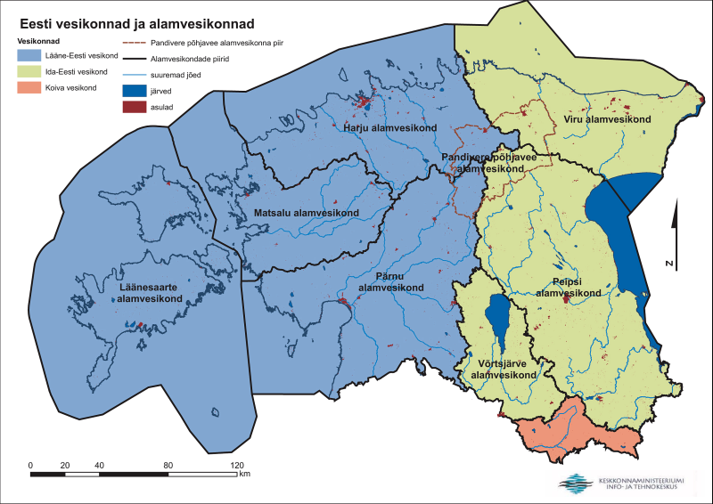
Watercourses are divided into river basins. Over time, they have been divided in different ways. For example, in the 2001 publication Eesti jõed (Estonian Rivers) [5], Estonian watercourses are divided into six main river basins (Lake Peipsi-Võrtsjärv, Gulf of Finland, Väinameri Sea, Gulf of Riga, Hiiumaa, Saaremaa). On the basis of the EU Water Framework Directive, since 2004, the territory of Estonia has been divided between three river basins – the Western Estonia, Eastern Estonia, and Koiva river basins.
Stagnant water bodies
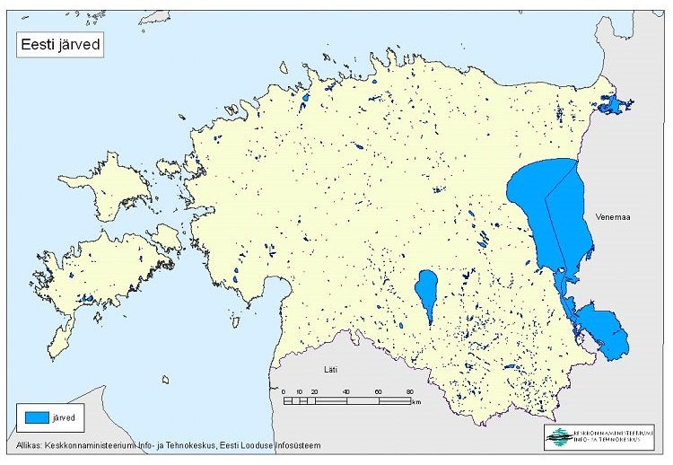
Estonia is a lake-rich country and stagnant water bodies make up 4.9% of the territory of our state. Lake Peipsi, Lake Võrtsjärv, and the Narva Reservoir make up the lion’s share of the total area of the lakes. Only about one tenth is left for smaller lakes [6]. According to the Estonian Nature Information System, there are more than 3,000 natural and artificial lakes in Estonia [2], but most of the smaller stagnant water bodies are missing from this calculation – such as bog ponds, old rivers, puddles, ponds, and quarries. In total, there may be almost 90,000 stagnant water bodies larger than 20 m2 in Estonia. Estonia ranks fourth in Europe in terms of the percentage of the state’s area covered by lakes [6].
The largest Estonian lakes are (according to the Estonian Nature Information System, as of 01 November 2023):
- Lake Peipus - 354338,7 ha
- Lake Võrtsjärv - 26956,2 ha
- Narva Reservoir - 10598,2 ha
- Lake Ülemiste - 942,7 ha
- Lake Saadjärv - 723,1 ha
- Lake Vagula - 602,7 ha
- Lake Suurlaht - 539,2 ha
- Lake Veisjärv - 480,7 ha
- Lake Ermistu - 452,5 ha
- Paunküla Reservoir - 420,2 ha.
The distribution of lakes in Estonia is also quite uneven. There are more lakes in the uplands of Southern Estonia, and the west coast and islands are also densely covered with small water bodies. At the same time, there are large areas in Central and Western Estonia where there are almost no natural lakes [1].
Most of Estonia’s natural lakes have been formed by ice sheets, but we also have bog lakes, beach lakes, karst lakes, lakes with meteorite origin (Lake Kaali), and artificial lakes. Because the ground is still rising slightly (2–3 mm per year in North-West Estonia) in the Estonian territory, the continuous formation of new coastal lakes continues here. However, due to their shallow depth and the continuation of the ground rising, such bodies of water are usually short-lived and disappear within a few hundred years [1].
The majority of Estonian lakes are shallow, mostly less than 10 metres deep; the maximum depth of only 13 lakes exceeds 20 metres [1]. Deep lakes are usually small in area and located in the areas of Upper Estonia [6].
The deepest lakes in Estonia are (according to the Estonian Nature Information System, as at 01 November 2023):
- Lake Rõuge Suurjärv - 38,0 m
- Lake Väiku-Palkna - 31,9 m
- Lake Udsu - 30,2 m
- Lake Tsolgo Mustjärv - 29,7 m
- Lake Uhtjärv - 27,6 m
- Lake Valgjärv (Koorküla Valgjärv) - 26,8 m
- Lake Kärnjärv (Pindi Kärnjärv) - 26,0 m
- Lake Piigandi - 25,3 m
- Lake Saadjärv - 25,0 m
- Lake Vellavere Külajärv - 25,0 m
Last modified: 17.11.2023
___________________
[1] I. Ott, H. Timm. Siseveekogud. Õpik kõrgkoolidele. 2020.
http://dspace.emu.ee/xmlui/handle/10492/6196
[2] Estonian Nature Information System, 26.05.2022. https://register.keskkonnaportaal.ee/register/search?objectType=BODY_OF_WATER
[3] https://et.wikipedia.org/wiki/Eesti_j%C3%B5ed
[4] H.Timm, R. Järvekülg, P. Pall, S. Vilbaste. 2019. Eesti jõed. Varrak, Tallinn.
[5] A. Järvekülg. 2001. Eesti jõed. EPMÜ zooloogia ja botaanika instituut. Tartu.
[6] R. Laarma jt. 2019. Eesti järved. Varrak, Tallinn.